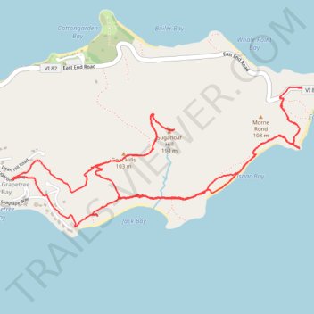
Trail near Point Udal connecting to GrapeTree
- Distance: 10.4 Km
- Elevation gain: 385 m
- Maximum elevation: 185 m
- Elevation loss: 369 m
- Minimum elevation: 0 m
- Moving time: 3 h 9 m
- Moving speed: 3.3 Km/h
- Maximum speed: 6.7 Km/h
- Total time: 4 h 8 m
- Global speed: 2.5 Km/h
Interactive trail map
Trail profile
- Distance: 10.4 Km
- Elevation gain: 385 m
- Maximum elevation: 185 m
- Elevation loss: 369 m
- Minimum elevation: 0 m
- Moving time: 3 h 9 m
- Moving speed: 3.3 Km/h
- Maximum speed: 6.7 Km/h
- Total time: 4 h 8 m
- Global speed: 2.5 Km/h
About this trail
Name: Trail near Point Udal connecting to GrapeTree trail, distance, elevation, map, profile, GPS track
Coordinates: 17.74560 -64.59062 17.75607 -64.56770