
Running
- Distance: 19.1 Km
- Elevation gain: 940 m
- Maximum elevation: 2,660 m
- Elevation loss: 940 m
- Minimum elevation: 2,350 m
- Moving time: 2 h 41 m
- Moving speed: 7.1 Km/h
- Maximum speed: 15.1 Km/h
- Total time: 2 h 54 m
- Global speed: 6.5 Km/h
Interactive trail map
Trail profile
- Distance: 19.1 Km
- Elevation gain: 940 m
- Maximum elevation: 2,660 m
- Elevation loss: 940 m
- Minimum elevation: 2,350 m
- Moving time: 2 h 41 m
- Moving speed: 7.1 Km/h
- Maximum speed: 15.1 Km/h
- Total time: 2 h 54 m
- Global speed: 6.5 Km/h
About this trail
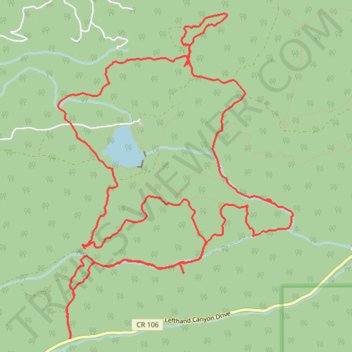
Name: Running trail, distance, elevation, map, profile, GPS track
Start: FS 370, Boulder County, Colorado, United States (40.06647 -105.45627)
End: FS 370, Boulder County, Colorado, United States (40.06650 -105.45626)
Coordinates: 40.06647 -105.45777 40.09762 -105.42830