Southeast French Park Loop Walk
- Distance: 4.1 Km
- Elevation gain: 86 m
- Maximum elevation: 260 m
- Elevation loss: 84 m
- Minimum elevation: 206 m
- Moving time: 1 h 25 m
- Moving speed: 2.9 Km/h
- Maximum speed: 5.5 Km/h
- Total time: 2 h 52 m
- Global speed: 1.4 Km/h
Interactive trail map
Trail profile
- Distance: 4.1 Km
- Elevation gain: 86 m
- Maximum elevation: 260 m
- Elevation loss: 84 m
- Minimum elevation: 206 m
- Moving time: 1 h 25 m
- Moving speed: 2.9 Km/h
- Maximum speed: 5.5 Km/h
- Total time: 2 h 52 m
- Global speed: 1.4 Km/h
About this trail
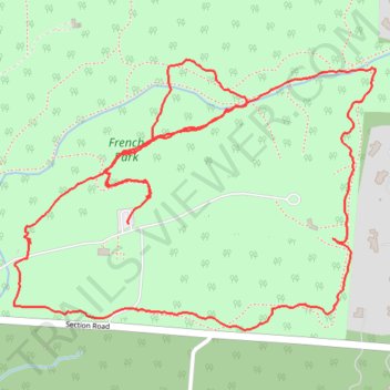
Name: Southeast French Park Loop Walk trail, distance, elevation, map, profile, GPS track
Coordinates: 39.19537 -84.42786 39.20095 -84.41823