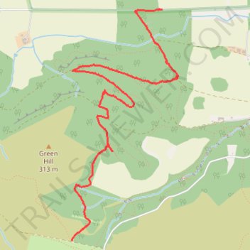
Walk at Maspie Glen area
- Distance: 4.7 Km
- Elevation gain: 39 m
- Maximum elevation: 301 m
- Elevation loss: 249 m
- Minimum elevation: 88 m
- Moving time: 1 h 9 m
- Moving speed: 4.1 Km/h
- Maximum speed: 15.0 Km/h
- Total time: 1 h 12 m
- Global speed: 3.9 Km/h
Interactive trail map
Trail profile
- Distance: 4.7 Km
- Elevation gain: 39 m
- Maximum elevation: 301 m
- Elevation loss: 249 m
- Minimum elevation: 88 m
- Moving time: 1 h 9 m
- Moving speed: 4.1 Km/h
- Maximum speed: 15.0 Km/h
- Total time: 1 h 12 m
- Global speed: 3.9 Km/h
About this trail
Name: Walk at Maspie Glen area trail, distance, elevation, map, profile, GPS track
Start: Craigmead, The Beech Hedges, Falkland, Fife, Scotland, KY15 7AE, United Kingdom (56.24350 -3.25109)
End: Falkland, Fife, Scotland, KY14 7RJ, United Kingdom (56.26024 -3.23931)
Coordinates: 56.24350 -3.25109 56.26024 -3.23726