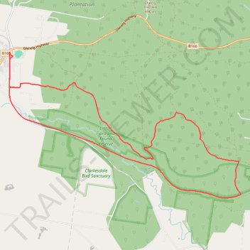
Happy Valley - Linton Flora and Fauna Reserve Loop Hike
- Distance: 15.2 Km
- Elevation gain: 270 m
- Maximum elevation: 408 m
- Elevation loss: 270 m
- Minimum elevation: 311 m
- Moving time: 3 h 21 m
- Moving speed: 4.5 Km/h
- Maximum speed: 8.1 Km/h
- Total time: 4 h 54 s
- Global speed: 3.8 Km/h
Interactive trail map
Trail profile
- Distance: 15.2 Km
- Elevation gain: 270 m
- Maximum elevation: 408 m
- Elevation loss: 270 m
- Minimum elevation: 311 m
- Moving time: 3 h 21 m
- Moving speed: 4.5 Km/h
- Maximum speed: 8.1 Km/h
- Total time: 4 h 54 s
- Global speed: 3.8 Km/h
About this trail
Name: Happy Valley - Linton Flora and Fauna Reserve Loop Hike trail, distance, elevation, map, profile, GPS track
Start: 9, Brooke Street, Linton, Victoria, 3360, Australia (-37.68378 143.56674)
End: 9, Brooke Street, Linton, Victoria, 3360, Australia (-37.68363 143.56680)
Coordinates: -37.71017 143.56605 -37.68299 143.62036
Other hiking, mountain biking, running and outdoor activity trails
Click on a trail to view its statistics, map and profile.
Nuggetty Gully - Linton Loop Hike
Distance: 11.7 Km • Elevation gain: 237 m • Maximum elevation: 471 m