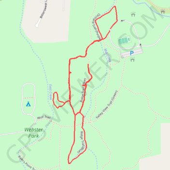
Webster Park
- Distance: 2.9 Km
- Elevation gain: 22 m
- Maximum elevation: 100 m
- Elevation loss: 21 m
- Minimum elevation: 83 m
- Moving time: 51 m 32 s
- Moving speed: 3.4 Km/h
- Maximum speed: 5.7 Km/h
- Total time: 53 m 27 s
- Global speed: 3.2 Km/h
Interactive trail map
Trail profile
- Distance: 2.9 Km
- Elevation gain: 22 m
- Maximum elevation: 100 m
- Elevation loss: 21 m
- Minimum elevation: 83 m
- Moving time: 51 m 32 s
- Moving speed: 3.4 Km/h
- Maximum speed: 5.7 Km/h
- Total time: 53 m 27 s
- Global speed: 3.2 Km/h
About this trail
Name: Webster Park trail, distance, elevation, map, profile, GPS track
Coordinates: 43.25090 -77.45537 43.25803 -77.45139
Other hiking, mountain biking, running and outdoor activity trails
Click on a trail to view its statistics, map and profile.