Import a GPX file

Mohawk Lakes via Spruce Creek

White River National Forest. #Hiking #MTB #Lake #Moutain #River #Waterfall #Forest

  • Distance: 13.5 Km
  • Elevation gain: 654 m
  • Maximum elevation: 3,785 m
  • Elevation loss: 654 m
  • Minimum elevation: 3,154 m

Interactive trail map

Trail profile

  • Distance: 13.5 Km
  • Elevation gain: 654 m
  • Maximum elevation: 3,785 m
  • Elevation loss: 654 m
  • Minimum elevation: 3,154 m

About this trail

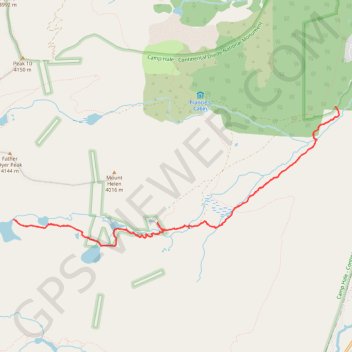
Name: Mohawk Lakes via Spruce Creek trail, distance, elevation, map, profile, GPS track

Start: Spruce Creek Trailhead, Spruce Creek Road, Summit County, Colorado, 80424, United States (39.43705 -106.05066)

End: Spruce Creek Trailhead, Spruce Creek Trail, Summit County, Colorado, 80424, United States (39.43705 -106.05066)

Coordinates: 39.41907 -106.10422 39.43705 -106.05006

Other hiking, mountain biking, running and outdoor activity trails

Click on a trail to view its statistics, map and profile.

Mohawk Lakes, Continental Falls and Mayflower Lake in White River National Forest

United States > Colorado > Summit County

The Spruce Creek Trail in Colorado's White River National Forest offers hikers a journey through dense forests and serene meadows, leading to the tranquil Mayflower Lake. Further along, the trail ascends beside the cascading Continental Falls, providing glimpses into the area's rich mining history with…

Distance: 10.9 Km • Elevation gain: 554 m • Maximum elevation: 3,690 m

Mayflower Lake, Continental Falls and Mohawk Lakes

United States > Colorado > Summit County

White River National Forest. #Hiking #Lake #Waterfall #River #Forest #Mountain #Nature

Distance: 12.3 Km • Elevation gain: 598 m • Maximum elevation: 3,730 m

Mayflower Lake, Continental Falls and Mohawk Lakes

United States > Colorado > Summit County

White River National Forest #Hiking #Lake #Waterfall #Mountain #Forest

Distance: 11.1 Km • Elevation gain: 559 m • Maximum elevation: 3,686 m