The Bluff Loop
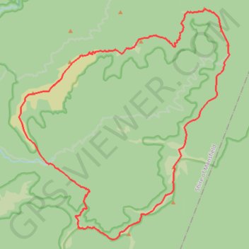
Interactive trail map
Trail profile
- Distance: 41.0 Km
- Elevation gain: 2,113 m
- Maximum elevation: 1,710 m
- Elevation loss: 2,113 m
- Minimum elevation: 827 m
About this trail
Name: The Bluff Loop trail, distance, elevation, map, profile, GPS track
Start: Brocks Road, Mount Buller, Shire of Mansfield, Victoria, 3723, Australia (-37.26715 146.50015)
End: Brocks Road, Mount Buller, Shire of Mansfield, Victoria, 3723, Australia (-37.26702 146.49960)
Coordinates: -37.30240 146.48324 -37.19530 146.60601
Other hiking, mountain biking, running and outdoor activity trails
Click on a trail to view its statistics, map and profile.