
Westmoreland County trails
Click on a trail to view its statistics, map and profile.
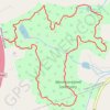
Afternoon hike at Westmoreland Grand Tour
United States > New York > Westchester County > Town of Bedford
Distance: 6.7 Km • Elevation gain: 189 m • Maximum elevation: 226 m
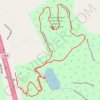
Westmoreland Sanctuary Raptor Ridge New Trail
United States > New York > Westchester County > Town of Bedford
Sanctuary Summit Hike
Distance: 3.6 Km • Elevation gain: 82 m • Maximum elevation: 245 m
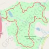
Westmoreland Sanctuary Grand Tour
United States > New York > Westchester County > Town of Bedford
Distance: 6.5 Km • Elevation gain: 176 m • Maximum elevation: 226 m
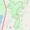
Westmoreland Sanctuary Loop
United States > New York > Westchester County > Town of Bedford
Distance: 8.9 Km • Elevation gain: 233 m • Maximum elevation: 226 m